Fundacja Rokita logo - Z pasji do historii
DSC Forst „Wald”

Site map

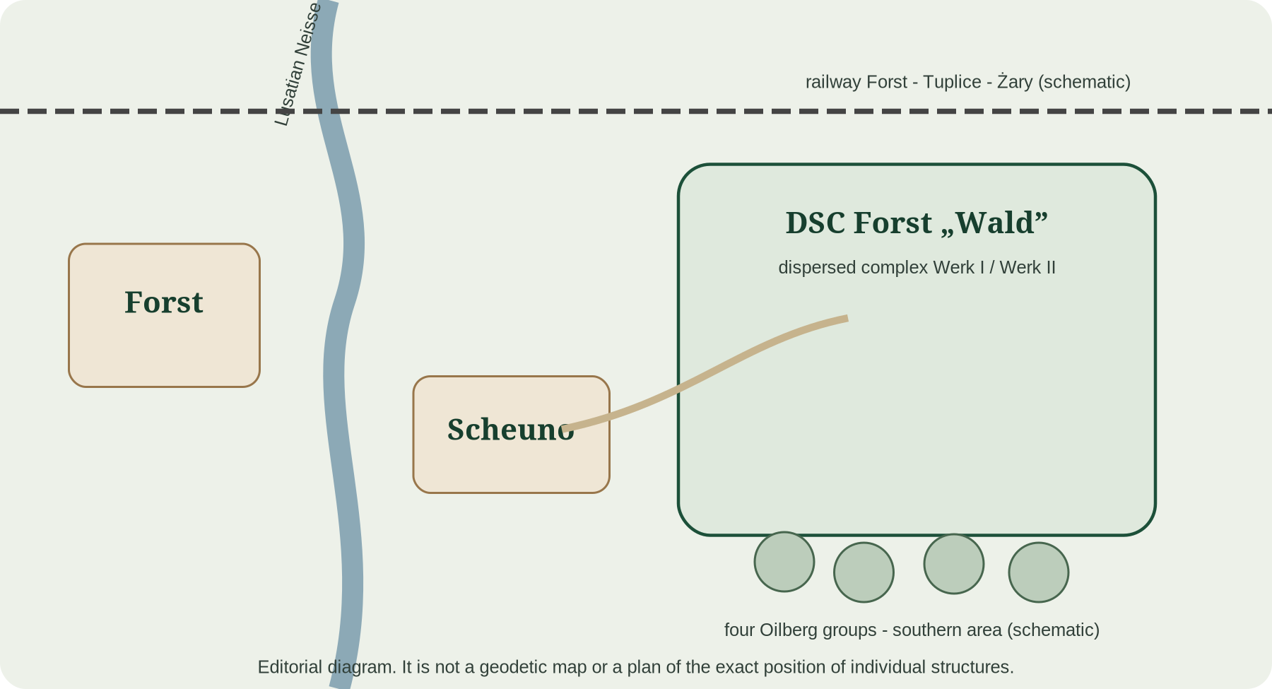
Orientation: Forst, Scheuno, railway, plant and Oilberg zones.

Orientation diagram of the DSC Forst complex
Orientation diagram of the DSC Forst complex showing spatial relationships between the principal plant zones and infrastructure. It is not a geodetic map and does not reconstruct parcel boundaries to survey accuracy.

Context

The map is designed for orientation between Forst, the Lusatian Neisse, Scheuno, the railway and the Wald plant to the east. It is intentionally schematic rather than a geodetic plan of individual buildings.

Key findings

The page separates securely documented facts from reconstruction. Comparative data from other DSC plants is used only when explicitly labelled as analogy.

How to read the evidence

Direct Forst records take priority. Report 133 is direct evidence for corporate structure, while its detailed technical inventory concerns Kraiburg.

Open questions

Further archival finds may refine dates, quantities and machine identifications. Uncertain points remain visibly marked.
Sources and state of research

The presentation distinguishes direct evidence, reconstruction and analogy. Old GEOS scans are not used as decorative illustrations.

  1. Fundacja Rokita - own materials and author study „Deutsche Sprengchemie Forst - Wald”.
  2. United States Strategic Bombing Survey, Report 133, Deutsche Sprengchemie GmbH, Kraiburg, Germany, 2nd ed., 1947.
  3. GKO Resolution No. 8609 ss - translation of the record concerning dismantling of the plant near Szeino/Forst.
  4. Bundesarchiv / DDB - Deutsche Sprengchemie GmbH.
  5. State Archives in Zielona Góra (Archiwum Państwowe w Zielonej Górze) - Deutsche Sprengchemie Werk Forst.
  6. G.E.O.S. Ingenieurgesellschaft mbH, expert report, 1995; Preuß et al., reconstruction of the POL plant, 1994.

Photographs and source documents

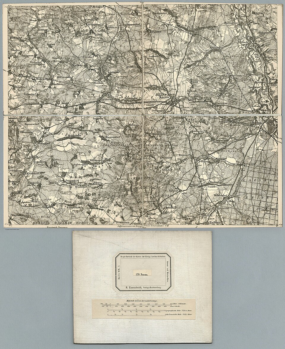
Arkusz Sorau z 1893 r. — źródłowy kontekst topograficzny.
Source material: 1893 Sorau map sheet - source-based topographic context.
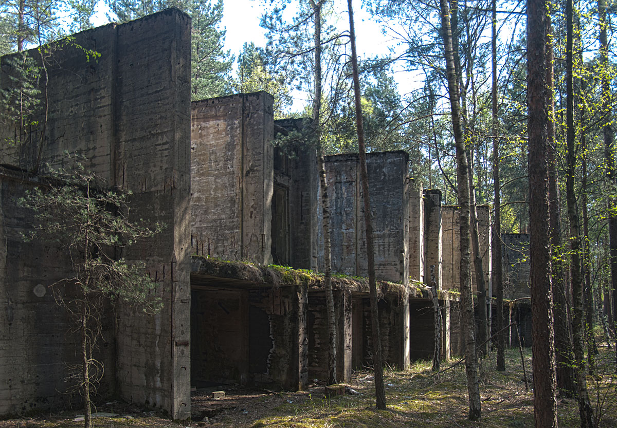
Fotografia terenowa pozostałości kompleksu.
Source material: field photograph of the surviving complex.